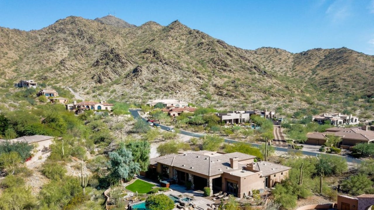
Drive up Thompson Peak Parkway from Bell Road and you pass the Gateway Trailhead entrance almost daily without giving it much thought. It sits right there, a half mile north, marked and easy to miss if you are running errands at the CVS across the street. Most people who live in Windgate Ranch know the trailhead exists. Far fewer know that the trail system behind it holds a pass and a stretch of path that carry the exact same name as the neighborhood they drive home to every night.
That is not a coincidence of branding. The Windgate Trail and Windgate Pass are real, named features inside the McDowell Sonoran Preserve, sitting behind Tom's Thumb and reachable from the trailhead at the end of your own parkway. And the way most hikers use that trailhead means the quietest, highest, most rewarding stretch of it goes almost untouched by the people who live closest to it.
The Name Was Never Just Marketing
Toll Brothers built the neighborhood in 2005, but the Windgate name predates the rooftops. Deeper into the preserve, past the switchbacks that climb toward Tom's Thumb, the trail network includes a segment simply called the Windgate Trail, which intersects the Tom's Thumb ascent and continues on to a high desert saddle called Windgate Pass. Whoever mapped this section of the McDowell Mountains gave the name to the land first. The subdivision borrowed it.
That detail matters for a practical reason. If you already assume Gateway Trailhead is just a parking lot with a loop trail, you are treating your own preserve access the way a visitor would, as a single stop rather than a network with a destination worth walking toward.
Where Almost Everyone Turns Around
Here is the part locals rarely piece together because most only ever do the first stretch. From the Gateway Trailhead lot, the easy half mile Saguaro Trail connects to Gateway Loop, and that first mile of loop is, by a wide margin, the busiest ground in the entire preserve section behind Windgate Ranch. Weekend mornings bring a steady mix of dog walkers, trail runners, and mountain bikers moving through that opening stretch in both directions.
Then something changes. Once you reach the junction marked as the Windgate Trailhead, roughly a mile into the loop, the character of the hike shifts. The trail steepens slightly as it curves toward a landmark called Inspiration Point, and the crowd that filled the first mile thins out almost immediately. You trade a busy sidewalk feel for something closer to solitude, with the granite spire of Tom's Thumb visible in the distance and the rocky slopes of Drinkwater and the McDowell Mountains replacing the wider valley views.
For anyone mapping the route from memory, the mile markers run roughly like this:
- 0 to 0.5 miles: Saguaro Trail connector from the parking lot, flat and easy
- 0.5 to 1.5 miles: Gateway Loop's busiest stretch, shared heavily with bikers
- Just past 1 mile: The Windgate Trailhead junction, where most casual visitors turn back
- Under 3 miles: Inspiration Point, with the crowd thinned out
- 3.8 miles: Windgate Pass, the high point of the hike at 3,031 feet
That final number is the one worth sitting with. Windgate Pass sits at the highest elevation on this route, a saddle between McDowell Peak and a formation known as The Lookout. From there the view splits in two directions, west back over Scottsdale and the McDowell Mountains you have been climbing through, east toward Fountain Hills with Four Peaks visible on the horizon. It is a five minute drive from your front gate and a view most residents have never stood in front of.
If You Want to Make a Loop of It
Windgate Pass does not have to be an out and back. Hikers who continue east past the pass connect to Bell Pass Trail, which eventually rejoins Gateway Loop and the Saguaro connector back to the parking lot, for a full loop of roughly 9.6 to 9.7 miles. It is a serious morning, not a stroll before breakfast, and it trades the crowded first mile for one of the more remote, less traveled corridors in this section of the preserve. If you have ever wanted a longer weekend hike that does not require driving anywhere, this is the version that starts and ends at the same lot you already know.
Timing It So the Desert Cooperates
The preserve does not close for the season, and this stretch of late August is exactly the window where that matters. Scottsdale's own guidance for the McDowell Sonoran Preserve recommends early morning access from May through September, with gates opening roughly 30 minutes before sunrise year round. That is not a suggestion so much as the operating reality of granite ridgelines that absorb heat and radiate it back at hikers who start too late.
The better news for anyone eyeing that 9.6 mile loop is that the calendar is about to work in your favor. Trail data for Gateway Loop points to October through May as the most comfortable stretch of the year to be out here, which means the next eight weeks are the transition, not the destination. If you have been putting off the full Windgate Pass hike because of the heat, late September is closer than it feels.
A few rules carry over from the rest of the preserve and are worth knowing before you go. Dogs are welcome on a leash. E-bikes are not permitted anywhere in the system. And on weekend mornings, you will likely see one of the blue-shirted volunteers from the McDowell Sonoran Conservancy stationed near the trailhead, ready to help with route questions if you want a second opinion on distance or difficulty before you commit.
The Table Is Already Set When You Get Back
The part of this routine that ties the whole thing together sits directly across the intersection from where you parked. The shopping center anchored by CVS at the northwest corner of Thompson Peak Parkway and Bell Road is called Windgate Crossing, and its tenant list reads like a post-hike checklist: Black Rock Coffee for the drive home, Sophia's Kitchen for the sit-down version with a patio big enough to hold a group and misters running through the warmer months.
Sophia's Kitchen has built its reputation on that patio, tucked at the base of the McDowell Mountains with wood-fired pizzas, house-made pasta, and a wine list built for lingering rather than rushing out. After a 9.6 mile morning, or even the shorter loop that turns back at Inspiration Point, it is the kind of stop that requires no driving and no real decision-making. You are back in the neighborhood's own retail center before you have finished cooling down.
That is the piece most write-ups about Windgate Ranch's trail access miss. They describe the amenities separately, the preserve here, the shopping there, without noticing that the neighborhood's name connects a specific pass in the mountains to a specific parking lot to a specific patio, all within a few minutes of each other. Living here means that loop is already built. Most people just have not walked all the way around it.
If you already call Windgate Ranch home and this is the first you are hearing about the pass that shares your neighborhood's name, you are not alone. It is easy to treat a five minute drive as unremarkable simply because it is close. The next clear morning is worth using differently.
For more on what makes daily life in this community distinct, from HOA amenities to the broader North Scottsdale corridor, the Mattisinko Group team keeps a closer eye on this neighborhood than most. If you are ever curious what a home like yours is worth in today's market, their free home valuation is a good place to start.